Location profile: Bisti Badlands
Location Profile: Bisti Badlands
Text and photos by Heather Cline
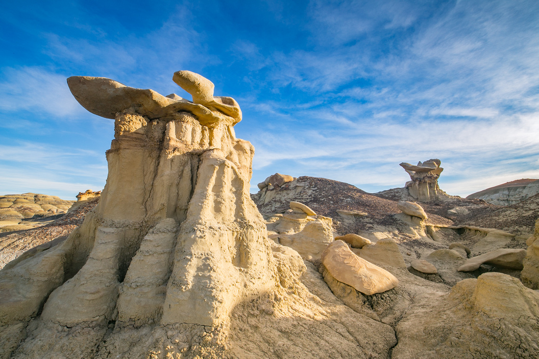
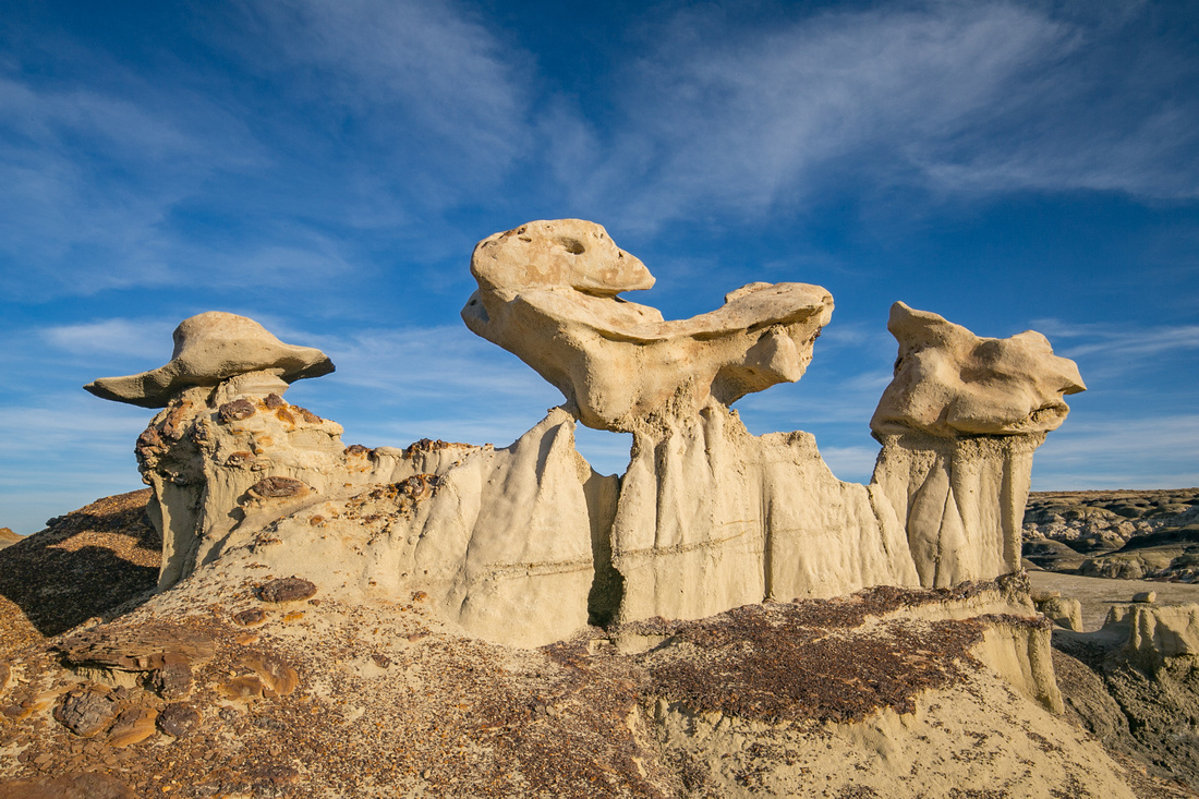
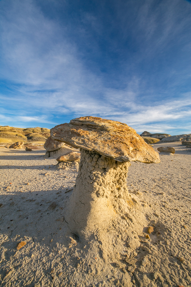
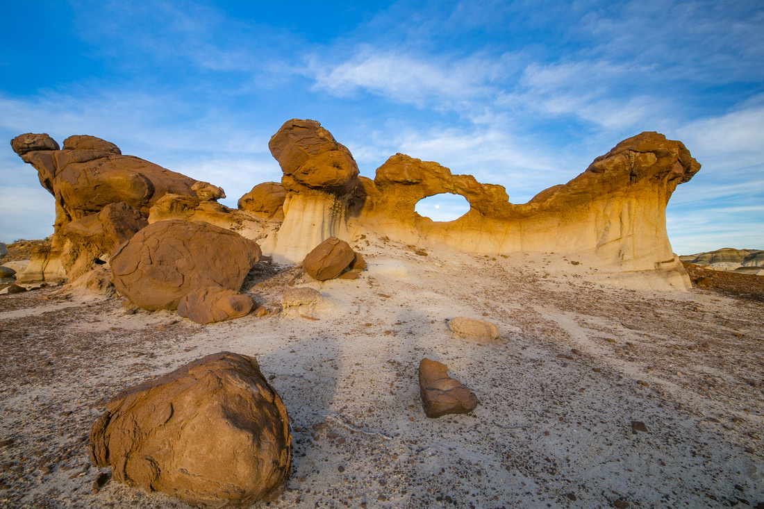
The Bisti/De-Na-Zin Wilderness area covers 45,000 acres of high desert badlands. It may be difficult to believe this desert wilderness was once a prehistoric swamp of an inland sea that contained many forms of life, but the formations provide a record of what that swamp once looked like. Fossils occur in the sedimentary layers of rock. In 1997, a tyrannosaur was discovered here and is now on display at the Museum of Natural History and Science.
|
What is Bisti Badlands?
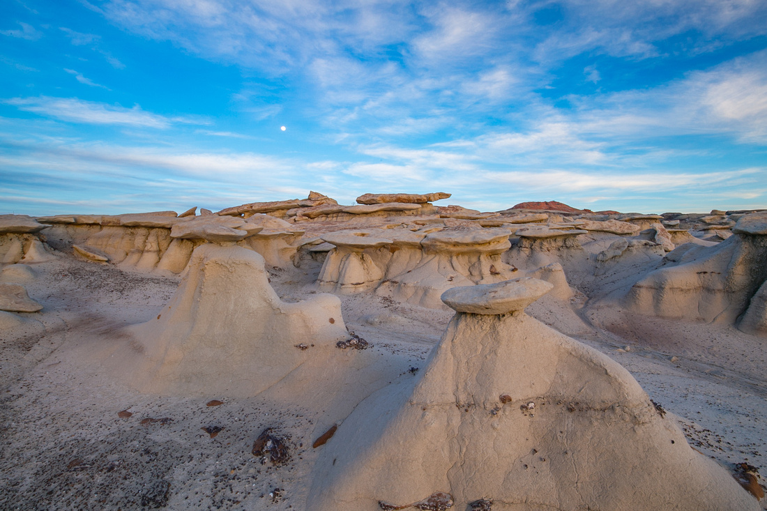
The Bisti/De-Na-Zin Wilderness area is administered by the Bureau of Land Management and features unique scenery set in badlands territory. The hoodoo rock formations in this area are made of sandstone, shale, mudstone, coal, and silt. Wind, water, and time have shaped the rock formations into pinnacles, spires, cap rocks, and other unusual shapes forming labyrinths that can give you the feeling of being on another planet.
|
Quick Facts
- No entrance fee
- Open year round
- Ample parking in a dirt lot
- No services or facilities
- Very limited cell phone reception in the area
- Hiking trails are open to foot traffic only
When is a good time to visit?
Spring, summer, and fall. While the area is open year round, rain can make the rocks slick and impassable. Avoid during rain and snow.
|
Sunrise and sunset are best for photography but any time of the day is good for hiking and observing the formations. However, there is no shade and summertime temperatures can become uncomfortable in the middle of the day.
Where is this park?
Bisti is located off NM 371 just under 36 miles south of Farmington or just under 45 miles north of Crownpoint. From NM 371, travel east on Road 7297 for 2 miles then turn left at the intersection. Its just under one mile to the Bisti Access Parking Area.
|
There is no formal or maintained trail. You can use a map, All Trails app (or something similar), or even go with a guide. I used a map and visual landmarks that I found online to guide my way. The first hoodoos are about 1.5 miles from the parking area with most formations laying within 4 miles of the parking area.
Why should I visit?
Hiking, geology, and photography.
|
The Farmington Convention & Visitors Bureau can help with trip planning as well.
I hope you enjoyed this post. To see more of my Bisti Badlands images, check out the gallery here.
