Behind the shot: The Pumpkin Patch
From time to time, I like to post information about places I have been to shoot, especially if getting there isn't terribly straightforward.
This post is intended to provide detailed information about finding and shooting the Pumpkin Patch near Anza Borrego State Park in Southern California.
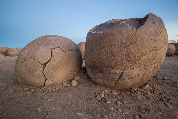

Let me start this post by saying Pumpkin Patch isn't a terribly easy location to access. There are three access "roads" that I am aware of. This route is less of a road, and more of a a series of desert washes loaded with deep sand and all kinds of fun things that want to flatten your tires. Please don't even attempt the drive unless you have a high clearance (preferably 4x4) vehicle. I drove it in a Toyota Tundra with a camper and I gave myself an hour to drive it each way, and given the limited driving directions I had, I was surprised I actually found it.
If you are driving a Jeep - this will be a walk in the park.
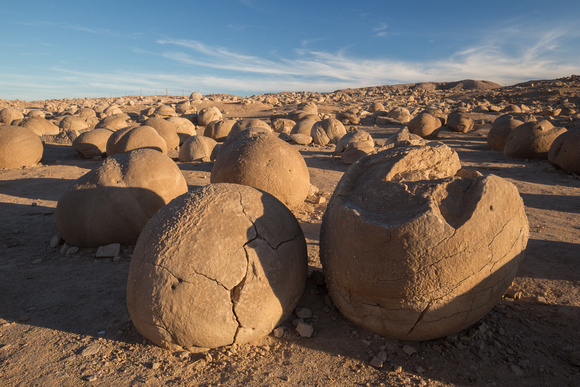

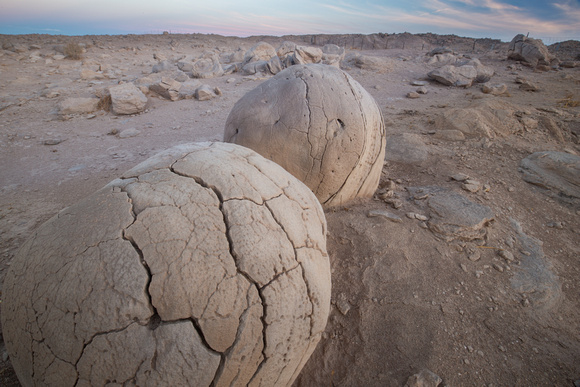
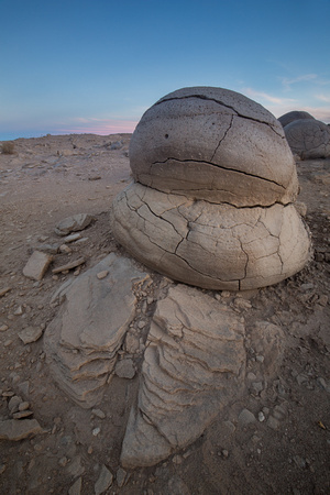
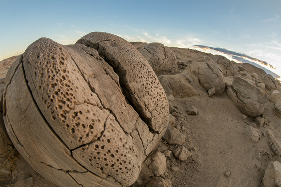
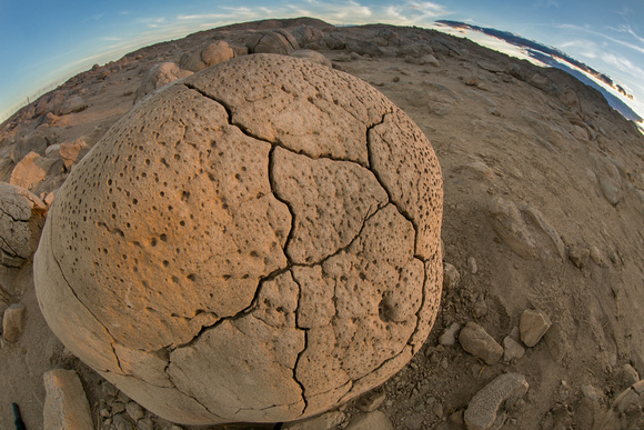
In case you haven't heard of the Pumpkin Patch, it is an acre sized area in Anza Borrego State Park that contains a large amount of rounded rocks called concretions, which are formed over time when loose, wet sand cements itself to a larger object underground. As the water evaporates, the sand hardens around the object. Wind erosion exposes the concretions and gives them their rounded (pumpkin like) shape.
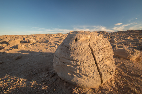

Here's a few details:
Area: Ocotillo Wells Vehicle Recreational Area, 16 miles east of Borrego Springs, California
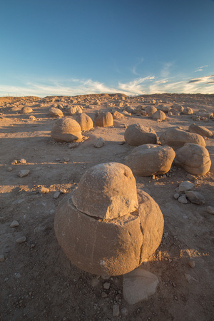

Location: GPS coordinates 33.2228 degrees north by -116.0688 degrees west


Driving directions:
This is one of three routes and is the middle choice in terms of difficulty but is pretty close to Borrego Springs. If you are camping at the Arroyo Salado Campground, this is an ideal route. Note: The total distance from County Road S-22
to the Pumpkin Patch is 7.4 miles.
1. From Borrego Springs, head east on County Road S-22 (towards Salton Sea)
2. Turn right at the sign for Arroyo Salado Campground, on Arroyo Salado Wash
3. You will reach the campground bathroom in 0.3 miles. Continue passed the bathroom on Arroyo Salado Wash for 0.2 miles.
4. At the T intersection, go left on Tule Wash (if you accidentally go right, the wash dead ends at 17 Palms)
5. After 0.4 miles on Tule Wash, you will reach 5 Palms
6. After 0.2 miles from 5 Palms, you will enter a series of narrow, red clay, twists and turns which ends after 0.7 miles but the road continues
7. The next junction is Cutoff Trail. Go left here and drive for 1.1 miles
8. The next junction is unsigned, go left here for another 0.3 miles to Ocotillo Wells
9. From Ocotillo Wells, travel another 1 mile to the Pumpkin Patch on your right
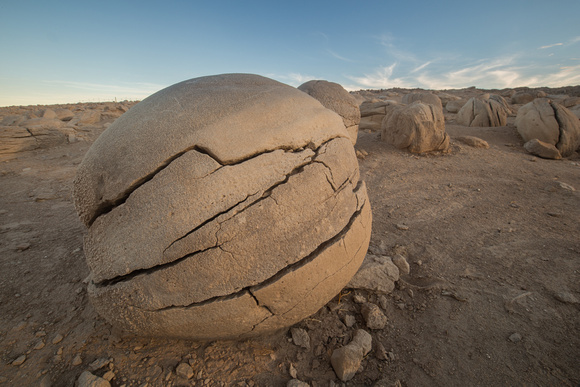

Parking situation: Ample. The site of the Pumpkin Patch has a large dirt parking area with picnic tables and a bathroom.
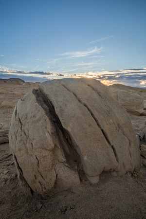

Trails: Free form walking through the formations. The area is surrounded by a fence.
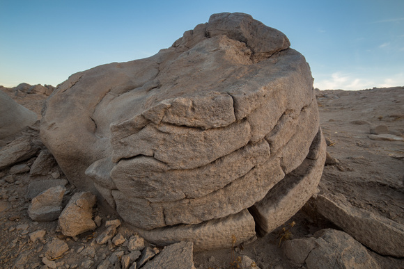

Best time of day to shoot: Sunrise, sunset, night.


Gear:
- Camera with a wide angle to telephoto lens, depending on what you are going for. I shot mostly wide.
- Lens hood for glare
- Polarizer for deepening the blue sky
- A flash or reflector to add light to your rocky subjects
- A tripod if shooting long exposures
- A travel buddy or be comfortable being completely alone. . . this place is remote and devoid of people. I was there for over 2 hours and encountered one couple who stayed for 10 minutes.
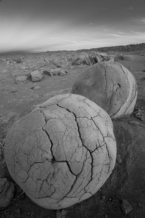

Weather / time of year:
It's preferable to have some clouds or interest in the sky, particularly if you are there at sunrise or sunset. There was a decent amount of clouds as I was driving in, but they cleared out dramatically by the time sunset came around. I hate when the clouds don't cooperate.
Here are a few final shots to give you a sense of the place.
